")
")
 Mountain, Tram Tau, Yen Bai")
Tinh Yen Bai Holiday Weather today
Date/time of update: April 27, 2024, 12:39 am, Timezone: GMT+7
Clear Sky
Temperature: 31.63°C
Temperature feels like: 30.63°C
Minimum Temperature: 31.63°C
Maximum Temperature: 31.63°C
Atmospheric pressure: 1005hPa
Humidity:32%
Visibility: 10000m
Wind speed: 0.62m/sec
Wind Direction: 120 degrees
Cloudiness: 0%
Sunrise: 2024-04-26 10:32:47
Sunset: 2024-04-27 11:24:52
The Ta Chi Nhu (Phu Song Sung) Mountain is located in Xa Ho Commune, Tram Tau District, Yen Bai Province. The mountain is 2,979m above sea level and is among the highest mountain peaks in Vietnam.
Travel Guide Overview for the Ta Chi Nhu (Phu Song Sung) Mountain in Yen Bai
The Ta Chi Nhu (Phu Song Sung) Mountain is popular among Vietnamese young tourists who love adventure travel and who love to explore new challenges. The mountain is not much known to foreign travelers to the Vietnam.
The Ta Chi Nhu Mountain is located to the north-northwest of Tram Tau Township. The mountain is part of the Phu Luong Mountain Range. The Phu Luong and the Ta Xua Mountain Range starts from one place: the Ta Xua runs south along the border between Son La and Yen Bai; the Phu Luong runs northwest-southeast.
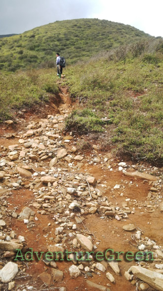
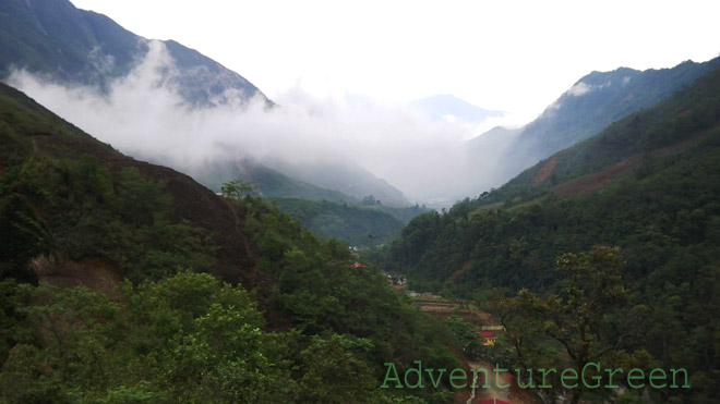
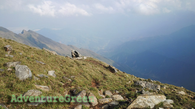
The trek to the summit of the Ta Chi Nhu goes through some patches of forest, but most of the time it is either grass-covered hillsides or hillsides covered with low plant bushes. The pros include that we can get broad views of the sublime nature most of the time! And the cons are that on sunny days we can’t get sunshades and there are no leaning points for us on the way up on down on steep gradients.
Weather and Climate, Best Time
+ Summer: May – August, strong sunshine, hot temperatures (33-39oC), possible typhoons between June-August;
+ Autumn: late August – early November, the temperatures are pleasant, possible typhoons in August-October, hillsides covered in wild flowers in October;
+ Winter: late November through January or early February, peach and plum blossoms in January-February;
+ Spring: February – April, lovely temperatures, possible strong sunshine on some days in April, dry weather mostly;

There may be typhoons in June – October which make a trekking trip to the Ta Chi Nhu (Phu Song Sung) Mountain not possible. There are more or less than 10 typhoons per year hitting inland Vietnam and half of which go to the North. There are several beautiful autumnal days between September – November that are great for climbing the Ta Chi Nhu (Phu Song Sung) Mountain. And typhoons can often be forecast 10 days in advance.
Winter months are cold and dry and there may be frost or snow on the mountain peaks. Some love snow would choose the winter to hike up the mountain then. The coldest time is often between mid December to mid January.
Spring time is certainly beautiful with blossoms everywhere: peach, plum,...

What to expect from a trekking adventure tour to Mount Phu Song Sung (Ta Chi Nhu)
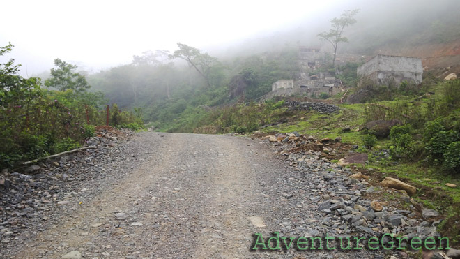
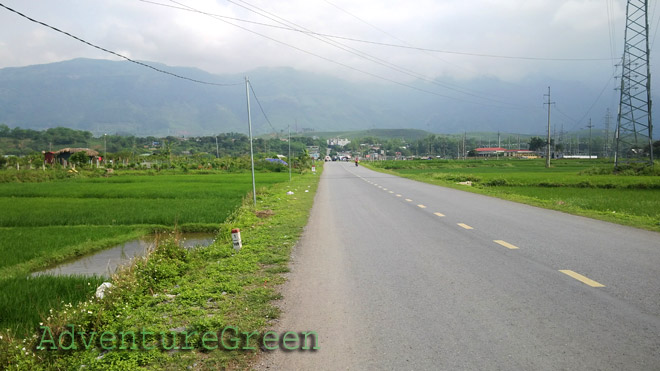
1/ Tram Tau – Xa Ho Commune – Chung Chua Nha Mountain Base (13km)
This leg of the adventure is done by motorbike. It is a fairly good road of which some parts are destroyed by rain water. Cars can not travel all the way given that the road is big enough!
The arrival point is at the gate leading to a lead mine where we start hiking through for 500m to the mountain base. Here the real trekking adventure begins!
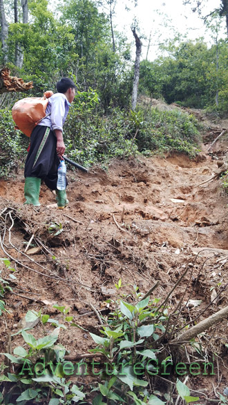
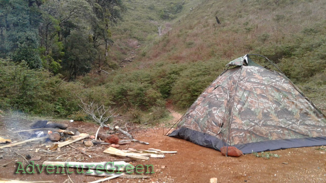
2/ Chung Chua Nha Mountain Base - Campsite at 2,400m (8km, 5-7 hours)
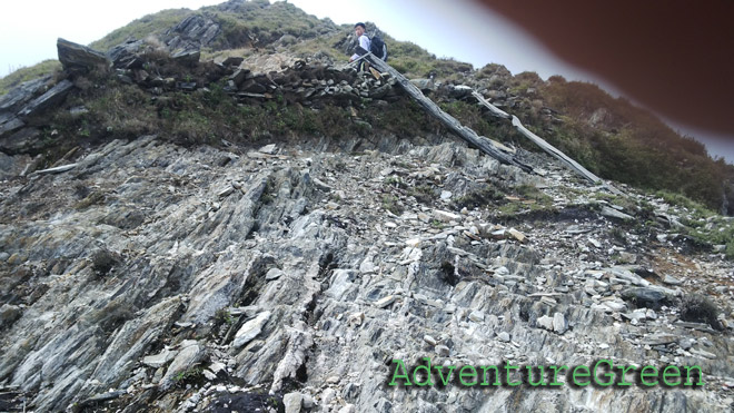
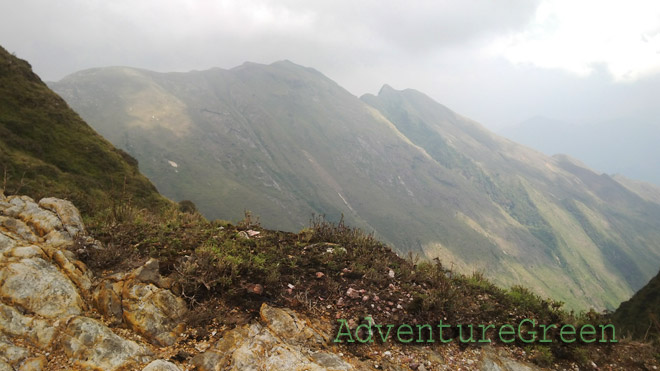
The trail goes up steeply most of the time (5-7 hours). It is quite slippery even on a dry day and there are no leaning points on the way up. There are certain hillsides where the gradients are steep, the only trail goes by a ravine on the one side and there is nothing to grab on the other side! When it is 2km from the hut, then the trail is mostly on a flat terrain with spectacular broad views!
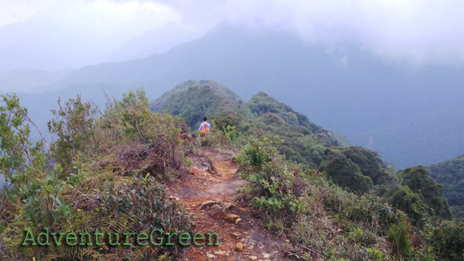
3/ Campsite to the Mountain peak (3-4km each way, 2-3 hours)
The trail is less steep and the landscape is ethereal! There are several mountain peaks on the way up and some of them have flat grounds on the top. The views are 360 degrees!
Where to stay
There is a wooden hut at 2,400m above sea level. The conditions are poor but there are toilets.
How to get there
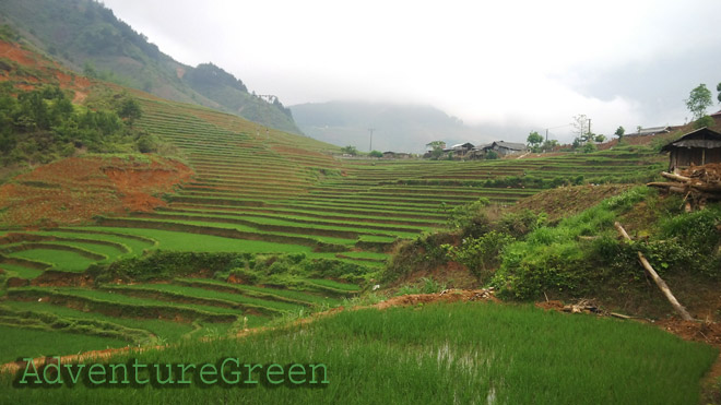
From Hanoi we travel northwest via Route 32 to Nghia Lo Town which is 150km away. And from Nghia Lo to Tram Tau it is 40km east.
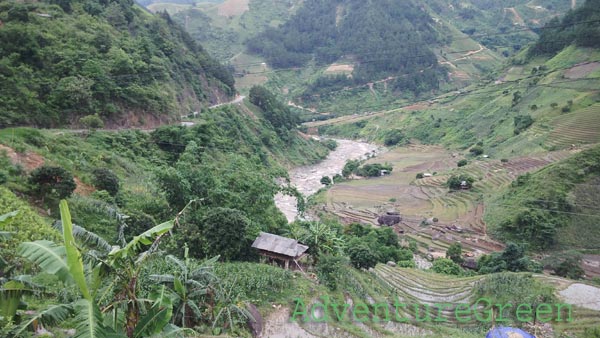
The point to start the trek is at the base of the Chung Chua Nha Mountain which is 10-13km from Tram Tau Township. This leg of the adventure is done by motorbike only, as the conditions are not good at some parts and cars can not travel all the way to the mountain base.
Yen Bai Average Monthly Rainfalls and Temperatures