")
")

Dien Bien Phu Holiday Weather today
Date/time of update: April 27, 2024, 1:35 am, Timezone: GMT+7
Clear Sky
Temperature: 32.73°C
Temperature feels like: 31.67°C
Minimum Temperature: 32.73°C
Maximum Temperature: 32.73°C
Atmospheric pressure: 1007hPa
Humidity:30%
Visibility: 10000m
Wind speed: 1.56m/sec
Wind Direction: 249 degrees
Cloudiness: 0%
Sunrise: 2024-04-26 10:39:31
Sunset: 2024-04-27 11:31:20
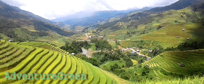
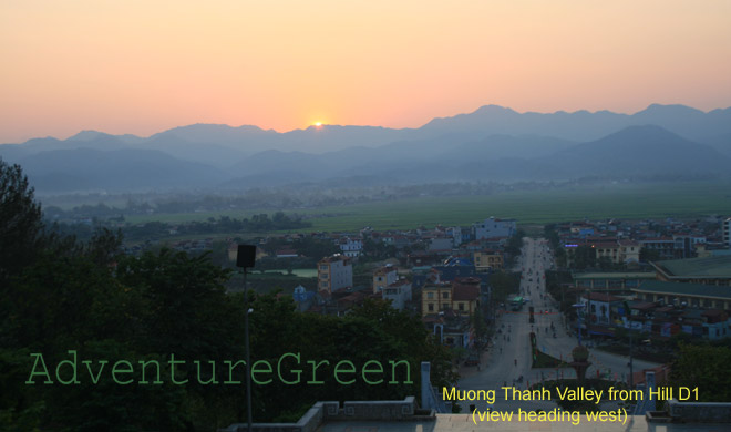
Dien Bien Phu City is the provincial capital of Dien Bien Province, 470km from Hanoi. Dien Bien Phu covers all of the Muong Thanh Valley, the biggest valley in the Northwest of Vietnam. Dien Bien Phu was the site of the decisive battle which put and end to the French rule of Vietnam.
Dien Bien Phu Travel Guide, Tourist Attractions, What to see in Dien Bien Phu
Dien Bien Phu was the site of Dien Bien Phu Battle which helped to shape up the course of the Vietnamese recent history. The battle had quite a powerful influence over the world’s history, too. Visiting Dien Bien Phu City, you will travel back in time to visit the different sites and recall the battle back then.
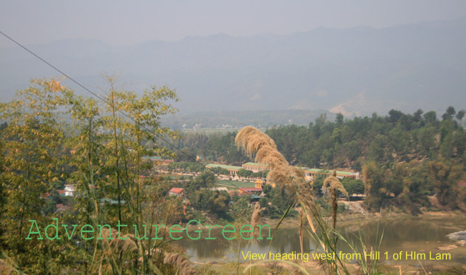
1/ Him Lam Hill
This is a group of three hills located to the Northeast of Dien Bien Phu commanding over route 41 (Route 279 now). Him Lam Hills were the strongest French post in Dien Bien Phu manned by 750 soldiers of the 3rd Battalion (3/13e Demi-Brigade de Légion Étrangère, 3/13th Demi-Brigade of Foreign Legion).
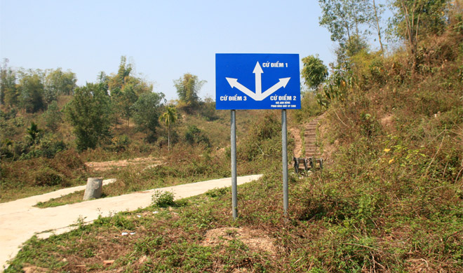
The battle at Him Lam Hills started from 17:05 on 13-March-1954 and ended at 23:30 on 13-March-1954. Most men of the 3rd Battalion were either killed or captured as prisoners of war, some escaped to the jungle. The battle at the Him Lam hills were the beginning of an end.
2/ Doc Lap Hill
Doc Lap Hill was an isolated barren hill 4km north of the Commander Post of Dien Bien Phu. The hill overlooked the route between Dien Bien Phu and Lai Chau. The French had built a 2-layer defense on the hill. The French force on Doc Lap was the 5th Battalion/7th Algerian Rifle Regiment (5/7 RTA) enforced by a Thai company.
The attack on Doc Lap was planned at 16:45 on 14-March-1954 but due to rainy weather as well as French bombardments that the plan was delayed.
14-March: 18:00 Vietnam artillery started shelling targets on and around the Doc Lap Hill.
15-March:
+ 02:00 A.M Viet Minh cannons were carried and put in place. Preparations done.
+ 03:30 A.M Viet Minh’s attack of Doc Lap Hill started.
+ 03:55 A.M Viet Minh’s howitzers ceased; close-range combat had started inside the stronghold.
+ 06:30 A.M Doc Lap Hill was overwhelmed. The 5/7 RTA was wiped out.
The French arranged re-enforcement and counter attack from 04:00 A.M to 07:30 A.M on 15-March but the efforts failed.
The quick fall of Him Lam and Doc Lap made the hedgehog much weakened and much more vulnerable. The ending results were more visible to both sides.
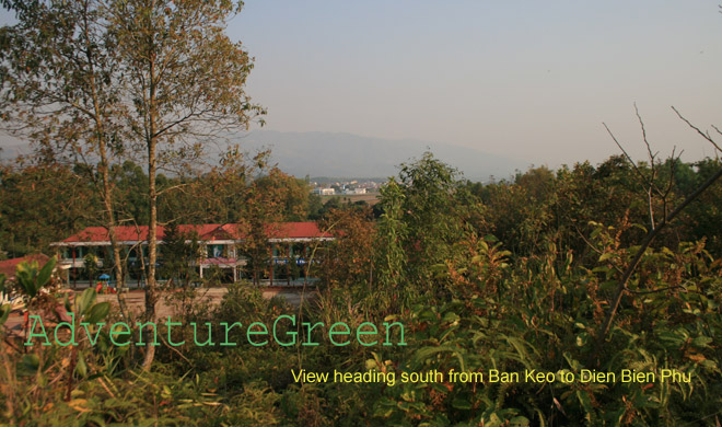
3/ Ban Keo Hill
Ban Keo was a White Thai village to the northwest of the Muong Thanh Airfield. The name of the village was used for the nearby knoll with two humps. The French deployed a stronghold to protect the northwestern side of the hedgehog: on the two humps of the knoll at Ban Keo and two other points on the paddy fields to the northwest of the Muong Thanh Airstrip. The French called this stronghold Anne Marie while the Vietnam addressed this as Ban Keo. Ban Keo belonged to the Northern Zone of the Hedgehog along with Doc Lap (Gabrielle).
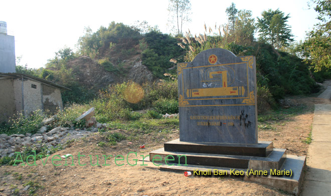
The French force at Ban Keo is the 3rd Thai Battalion (BT 3) which included Thai soldiers from Nghia Lo and Son La and which proved their combat capability at Na San in 1953.
The successive falls of Him Lam and Doc Lap between 13-April and 15-April proved that Viet Minh could annihilate the best European and African units in the French forces at Dien Bien Phu. That was visible to all participants including the Thai soldiers at Anne Marie. From 16-April, along with unconditional delivery of the wounded from Doc Lap Hill Battle, the Viet Minh also used loudspeakers to persuade the Thai soldiers at Anne Marie to lay down weapons and return home.
In the morning of 17-April, upon rumors that the Viet Minh was about to hammer Anne Marie, the Thai soldiers stampeded to the forest. Lieutenant Clarchambre who was commander in chief of Anne Marie 1 and 2 (the knoll) called Muong Thanh that they had to withdraw to the Central Zone immediately. Ban Keo fell quickly without a bullet fired by 36th Regiment of 308th Division.
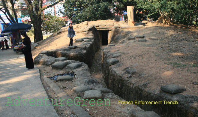
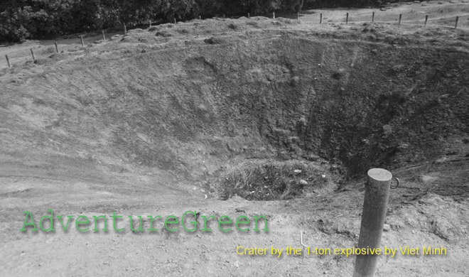
4/ A1 Hill with two auxiliary hills (Doi Xanh and Doi Chay)
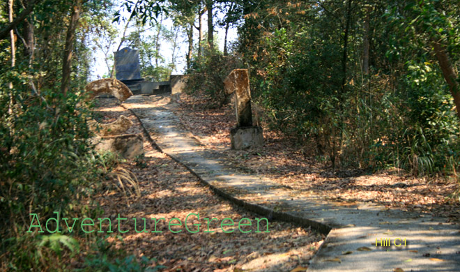
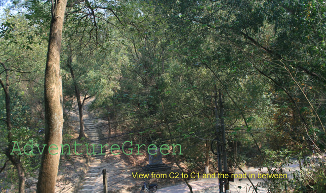
5/ C1 & C2 Hills
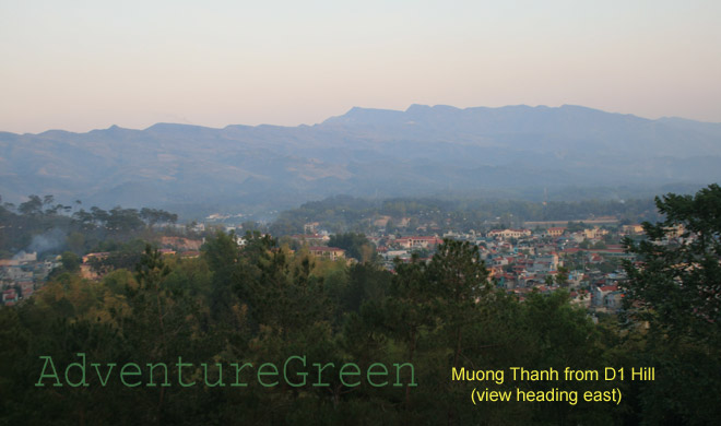
6/ D1 Hill (Dominique 2)
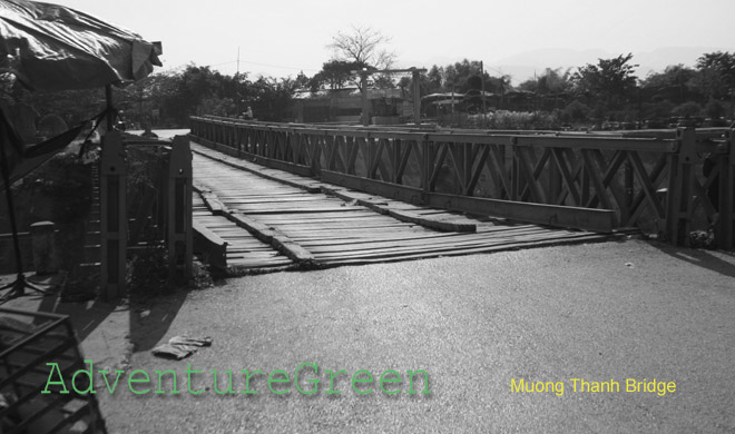
7/ The Muong Thanh Bridge
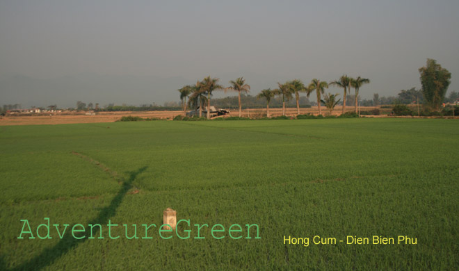
8/ Former Hong Cum Zone (Isabelle)
9/ Dien Bien Phu Airfield (from outside)
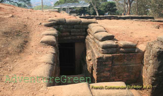
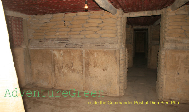
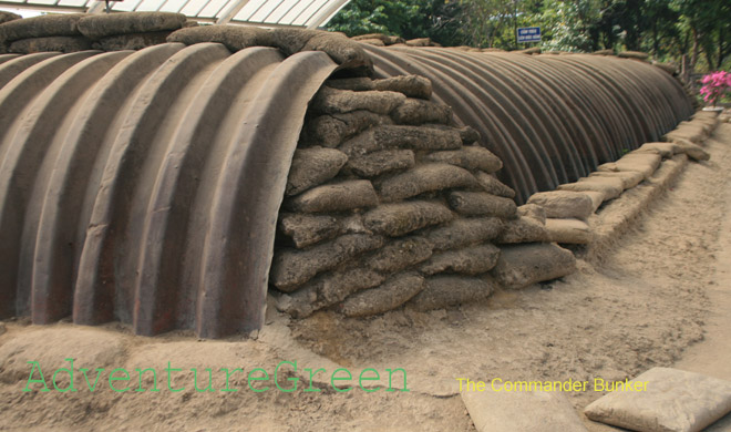
10/ The Commander Bunker
11/ Dien Bien Phu Museum
Adventure Travel, Things to do in Dien Bien Phu
1/ Adventure Travel
AdventureGreen arranges adventure tours by car to Dien Bien Phu City. On the tour, we visit different sites in the city as well as Thai villages.
2/ Historical Tours
AdventureGreen operates in-depth historical tours by car or jeep to Dien Bien Phu City and other historical sites in the Northwest, Northeast of Vietnam.
How to get to Dien Bien Phu and how to travel around Dien Bien Province
1/ Son La – Dien Bien Phu (150km via Route 6)
2/ Mu Cang Chai – Quynh Nhai – Tuan Giao - Dien Bien Phu (via Route 279)
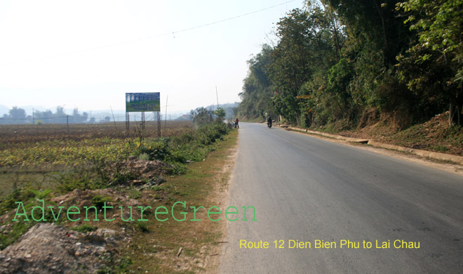
3/Lai Chau - Muong Lay - Muong Cha - Dien Bien Phu (via Route 4D and Route 12)
4/ Dien Bien Phu - Tay Trang Border Checkpoint to Laos

Dien Bien Average Monthly Rainfalls and Temperatures