")
")

Tinh Yen Bai Holiday Weather today
Date/time of update: April 27, 2024, 12:39 am, Timezone: GMT+7
Clear Sky
Temperature: 31.63°C
Temperature feels like: 30.63°C
Minimum Temperature: 31.63°C
Maximum Temperature: 31.63°C
Atmospheric pressure: 1005hPa
Humidity:32%
Visibility: 10000m
Wind speed: 0.62m/sec
Wind Direction: 120 degrees
Cloudiness: 0%
Sunrise: 2024-04-26 10:32:47
Sunset: 2024-04-27 11:24:52
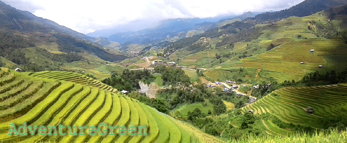
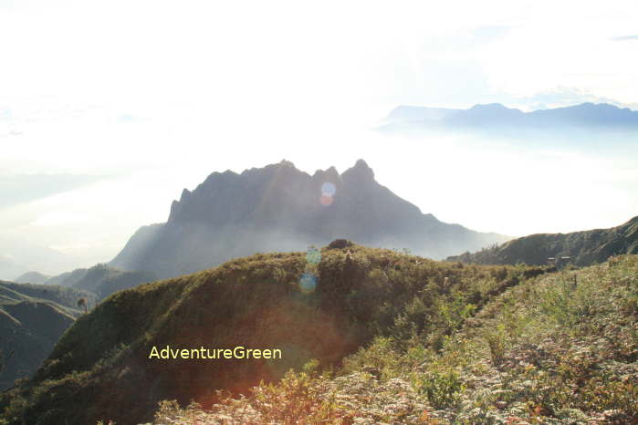
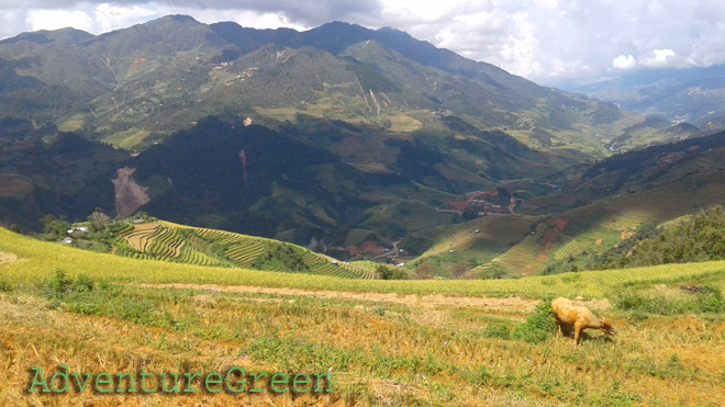
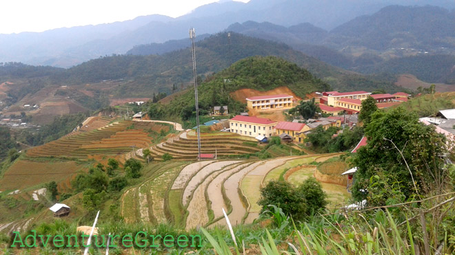
The Lung Cung Mountain is located in Nam Co Commune, Mu Cang Chai District, Yen Bai Province. The peak of the mountain is 2,913m above sea level and this is among the highest mountain peaks in Vietnam.
Travel Guide Overview for Lung Cung Mountain in Mu Cang Chai Yen Bai
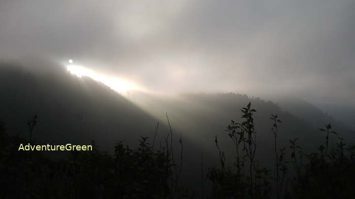
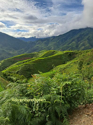
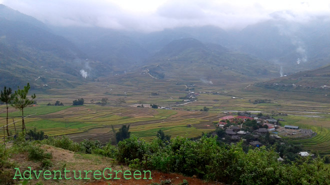
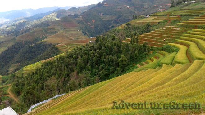
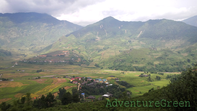
The landscape encountered on a trek to the peak of the Lung Cung Mountain include: breathtaking rice terraces if in rice season, vast pasture at the Ta Co Y Valley (1,900m), bamboo forest, evergreen forest with big mossy timber trees, a mountain peak with a flat ground and panoramic views of the sublime nature!
The plants encountered on the trek to the peak of the Lung Cung Mountain include: Chestnut Tree, Bamboo, Maple, Reed, Rhododendron, Hmong Apple…
Weather and Climate, Best Time
+ Summer: May – August;
+ Autumn: late August – early November, the maple leaves turn red or yellow;
+ Winter: late November through January or early February;
+ Spring: February – April, the Rhododendron offers full blossoms;
There may be typhoons in June – October which make a trekking trip to the Lung Cung Mountain not possible. There are more or less than 10 typhoons per year hitting inland Vietnam and half of which go to the North. There are certainly beautiful autumnal days between September – November that are great for climbing the Lung Cung Mountain.
Late September and early October is the time that rice terraces turn into shiny yellow colors!
Winter months are cold and dry and there may be frost or snow on the mountain peaks. Some love snow would choose the winter to hike up the mountain then.
Spring time is certainly beautiful with blossoms everywhere: peach, plum, rhododendron...
What to expect from a trekking adventure tour to Mount Lung Cung in Mu Cang Chai?
There are different trekking routes to the peak of the Lung Cung Mountain, each of which offer slightly different landscapes and each of which is with different level of difficulty and distance.

1/ Tu Le – Nam Co Commune (either Tu San Village or Lung Cung Village) – Lung Cung
+ 15km on motorbike on a rock-strewn path from Tu Le to Nam Co;
+ 10km uphill from Nam Co to Tu San Village or 13km to Lung Cung Village;
+ 8km (6-7 hours trek) on steep mountain slopes going through bamboo forest and forest with big timber trees to the mountain hut for the night;
+ 2.5km (1 hour 30 minutes) uphill to the peak of the Lung Cung Mountain (2,913m).
2/ Mu Cang Chai – Che Cu Nha Commune (Thao Thua Chai Village)
+ 20km (30 minutes by motorbike) La Pan Tan – Che Cu Nha or 15km (20 minutes by motorbike) Mu Cang Chai Township – Che Cu Nha: steep path all the way, possible to travel on in a rain;
+ 9km (5-6 hours) Thao Thua Chai Village (1705m, Che Cu Nha) – the Lung Cung Mountain Peak, broad views of mountain, reeds, valley of Ta Co Y;
Where to stay
There is a wooden mountain hut (2,600m) with poor facilities which could accommodate 50 persons a night. There is only one toilet. If there are more guests, it would require to bring your own tent.
How to get there
The Lung Cung Mountain is 25km north of Tu Le and 28km northeast of Mu Cang Chai Township via beeline.
From Hanoi follow Route 32 to the Tu Le Valley, the trek can start from here or from Mu Cang Chai:
1/ Tu Le – Nam Co – Tu San Village (25km)
This route offers the most beautiful landscape and the one with grade of difficulty in between that via the Lung Cung Village and via Thao Thua Chai Village. This route is not recommended when it rains.
2/ Tu Le – Nam Co – Lung Cung Village (28km)
This route is the longest and most difficult route of the tree routes to the peak of the Lung Cung Mountain. This route is not recommended when it rains.
3/ Mu Cang Chai – Che Cu Nha (Thao Thua Chai Village)(10km)
This route is the shortest and easiest trekking route of all. This route can be done still even when it rains.
Yen Bai Average Monthly Rainfalls and Temperatures