")
")

Tinh Lao Cai Holiday Weather today
Date/time of update: April 27, 2024, 1:48 am, Timezone: GMT+7
Clear Sky
Temperature: 27.87°C
Temperature feels like: 26.8°C
Minimum Temperature: 27.87°C
Maximum Temperature: 27.87°C
Atmospheric pressure: 1006hPa
Humidity:25%
Visibility: 10000m
Wind speed: 0.57m/sec
Wind Direction: 171 degrees
Cloudiness: 0%
Sunrise: 2024-04-26 10:34:28
Sunset: 2024-04-27 11:28:31
The Pavie Path was built by the French in 1927. The surface was paved with slabs of stone or gravel all the way for 70-80km of which only 15km remains nowadays.
Travel Guide Overview for Pavie Path, Lao Cai – Lai Chau
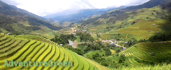
The path was made for border patrol and for transporting of forest produce (cardamom,…) from Lai Chau to Lao Cai. The landscapes the path travels through include flat valley, forest and mountains, streams. The highest point is at the Windy Pass (2,000m).
Weather and Climate, Best Time to Visit
The trekking tour on the Pavie Stone Path should not be done when the region is under impact of a typhoon. There are legs of the trek which we have to hike in the bed of two rivers for a few hundred meters each and when it rains it be may a big problem to pass through.
The dry time is from late November through April; it is cold in November-February and is pleasant temperatures in March-April.
Trekking Tour Itinerary for the Pavie Path between Lao Cai and Lai Chau
From Lao Cai City travel for 70km to Sang Ma Sao Commune, Sang Ma Sao District, Lao Cai Province. The trek from Cha Pha Village in Sang Ma Sao to Sin Suoi Ho takes 10 hours.
0600 A.M Start the trek at Cha Pha Village. The first leg goes through a lovely flat valley surrounded by forested mountains. Then comes a forest with big and mossy timber trees, the route goes up slightly. There are quite a few cardamom plantations under the canopy of big trees. The maple tree leaves turn beautiful should it be in autumn (September – November).
On the way, there are two streams on the bed of which we have to travel in to proceed our adventure.
1200 A.M Lunch by a stream.
1600 Arrive at Sang Ma Pho Village (Sin Suoi Ho Commune, Phong Tho District, Lai Chau Province). From the village to Sin Suoi Ho Eco Site it is 10km and from here it is big road that cars could travel on. It is 25km from Sin Suoi Ho to Lai Chau City.
How to get to there
From Lao Cai, travel to Den Sang Commune (Bat Xat) either via Sapa or via Ban Vi – Ban Xeo. This part of the trip is 65-70km and the road condition is not good via Ban Vi – Ban Xeo or from Sapa to Muong Hum.
From Den Sang to Nhiu Co San (Sang Ma Sao Commune) or Cha Pha Village, the small trail is 9km in bad conditions.
Lao Cai weather and climate