")
")

Pu Ta Leng Mountain, which is 3,049m above sea level, is on the border between Bat Xat District of Lao Cai Province and Tam Duong District of Lai Chau Province. In Lai Chau, the mountain is in Ho Thau Commune and Ta Leng Commune, Tam Duong District. In Lao Cai, the mountain is in Trung Leng Ho Commune, Bat Xat District.
Travel Guide to the Pu Ta Leng Mountain in Lao Cai and Lai Chau
Weather and Climate, Best time to visit
Pu Ta Leng Mountain is in a region with tropical monsoon climate. In the winter months (November – February), the Northeasterly Monsoon causes cold and dry temperatures in the region. There is often snow or frost in the period between mid December – mid January.
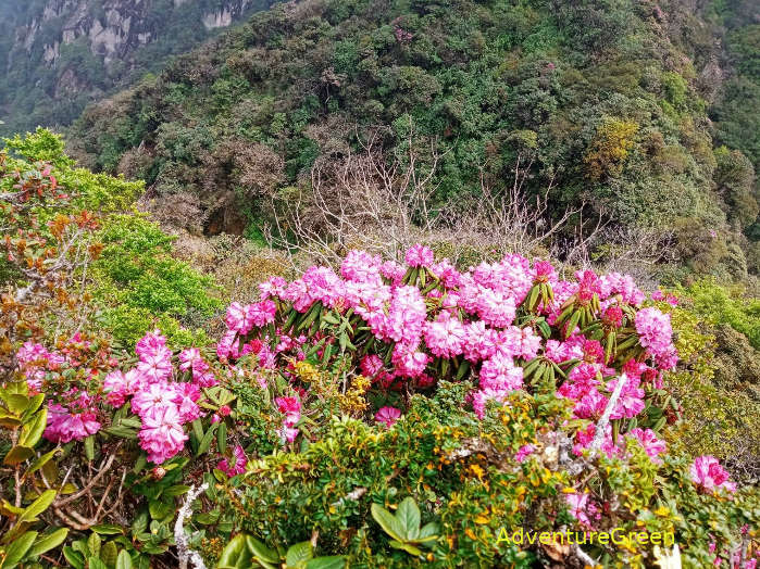
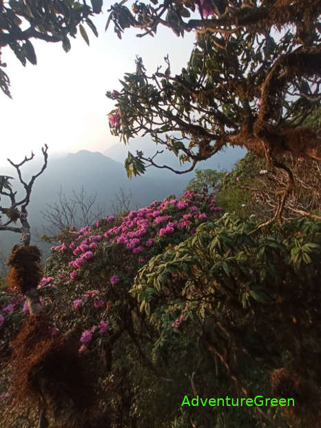
In March – April it is spring time which is dry and with pleasant temperatures mostly. The rhododendron forsts on the mountain slopes yield an amazing beautiful picture.
In May – July it is summer time with rain; if there is a typhoon then it is torrential rain with possible landslides.
In August – early November, it is autumn with possible typhoons in between August and October. If without a typhoon, it is often very nice weather with mild sunshine and pleasant temperatures. The maple forest offer amazing yellow and red colors.
What to expect on a trekking trip to the peak of the Pu Ta Leng Mountain?
There are different routes to the peak of the Pu Ta Leng Mountain. The below trip starts from Ho Thau and concludes at the Ta Leng Village. This itinerary is for 3 days and 2 nights.
Day 1: Trekking Ho Thau – Campsite at 2400m (7.5 – 8 hours)
The first leg of the adventure tour is to trek along the bed of a river (Suoi Thau) with several huge blocks of rocks and with some parts under water in the rainy season. This first leg of the journey takes approximately over 1 hour. Then the hike is on steep terrain through cardamom plantations and primeval forest.
Day 2: Hiking Campsite – Pu Ta Leng Peak – Campsite (7-8 hours)
The trek goes through low bamboo forest for most of the way. Once near the summit there is a forest of rhododendron which offers lovely flowers in March-April. The trek to the summit from the hut takes 4.5-5 hours and the hike back to the campsite from the summit takes 3-3.5 hours.
Day 3: Trekking Campsite – Ta Leng Village (5-6 hours)
The trek downhill goes through forest, rhododendron forest and later rice terraces as it is near the village.

Where to stay
There are mountain huts at 1,800m and 2,400m with capacity of 50-80 persons per night. The facilities are poor.
Ho to there there
The Pu Ta Leng Mountain can be reached via Lai Chau or Lao Cai. On the Lai Chau side, you need to travel for 12km from Lai Chau City to Ta Leng Commune, or 12km to Giang Ma Commune, or 28km to Ho Thau Commune. There are trails to the summit of Pu Ta Leng from these three spots with distances from 12-25km each.
On the Lao Cai side, you have to travel 85km from Lao Cai City or 55km from Sapa Town to Trung Leng Ho Commune (Bat Xat District) where the trek starts. The trekking route is 10km each way.
Lai Chau Average Monthly Rainfalls and Temperatures


