")
")

Tinh Lao Cai Holiday Weather today
Date/time of update: July 28, 2026, 12:00 am, Timezone: GMT+7
Overcast Clouds
Temperature: 18.42°C
Temperature feels like: 18.93°C
Minimum Temperature: 18.42°C
Maximum Temperature: 18.42°C
Atmospheric pressure: 1007hPa
Humidity:100%
Visibility: 5659m
Wind speed: 0.9m/sec
Wind Direction: 94 degrees
Cloudiness: 100%
Sunrise: 2026-07-27 10:33:53
Sunset: 2026-07-28 11:46:53
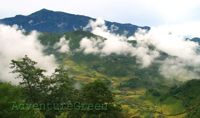
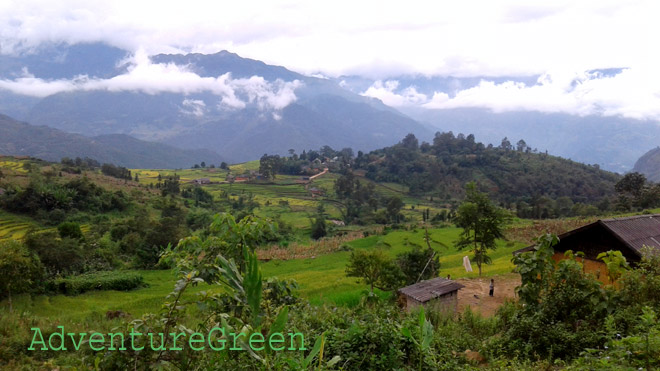
The Lao Than Mountain is located in Bat Xat District, Lao Cai Province. The mountain is right on the border between Den Sang Commune to the southwest and Trinh Tuong Commune to the northeast, and Y Ty Commune to the northwest. Mount Lao Than is 2,860m above sea level and is among the highest mountain peaks in Vietnam.
Travel Guide Overview for the Lao Than Mountain in Lao Cai
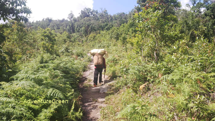
Compared to other high mountain peaks in the Northwest of Vietnam, trekking to the summit of the Lao Than Mountain is an easier adventure. It is easier but it certainly requires some physical and mental efforts.
For a fit and experienced trekker, you can complete an adventure to the summit and back to the mountain base in 8-10 hours. For others, it is recommended to stay overnight at a campsite at 2,560m where you can enjoy an amazing night amid the wilderness.
Weather and Climate, Best Time to Visit
There may be typhoons in Northern Vietnam between June and October; during this period it not recommended to take a trip to the Lao Than Mountain if you happen to travel when the region is under impact of a typhoon. Normal weather patterns by month are as follows:
+ December – January: winter, dry days mostly, cold and possibly snow/frosts between 20-December and 15-January, peach and plum blossoms in January;
+ February – April: spring, dry days mostly, peach and plum blossoms in February, Rhododendron flowers in March-April;
+ May – August: summer, hot (not on high altitudes), strong sunshine, possible typhoons June-August with torrential rain;
+ September – November: autumn, pleasant temperatures, lovely weather mostly except for time under typhoon impact (4-6 typhoons/year in northern Vietnam between June-October).
What to expect on the trekking tour
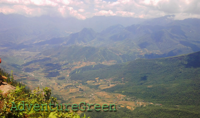
The first leg is for 2km on a quite flat terrain which travel through a thin forest. Then comes a steep gradient in the forest for 1km. After that the terrain is flat again for 2km to the campsite with broad and spectacular views of the mountains and valleys around.
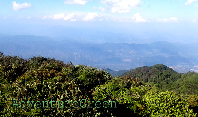
The last leg of the adventure is from the campsite to the summit which is 800m-1km and which is very steep and slippery. There is nothing for you to hold on to on the way up or down and the winds are very strong up here. There is nothing to obstruct the views and there is nothing to block the very strong winds! This leg of the trip takes 1 hour up to the summit and 30-40 minutes back to the campsite.

AdventureGreen organizes trekking tours to Mount Lao Than along with other spectacular mountain peaks in Lao Cai Province, Vietnam. There are also opportunities to go on hiking tours from one ethnic village to another to learn more about the life of these mountain dwellers. The landscape in Bat Xat is just breathtaking.
How to get there
From Lao Cai City we have to travel to Y Ty Commune of Bat Xat District first and this leg of the journey is 80-90km depending on the route you take, either via Sapa or via provincial route 156/158. The route via Sapa is longer but slightly in better conditions, especially the leg between Sapa and Lao Cai is great mostly.
The second leg of the adventure is from Y Ty Commune to the point where the trek starts and this leg is 15km. The road is in very bad condition and you can choose to travel by motorbike or on foot.
Alternatively, we can travel from Lao Cai to Den Sang Commune 60-70km depending on the route and from Den Sang to the point where the trek starts is 15km.
Lao Cai Average Monthly Rainfalls and Temperatures


