")
")
 Mountain")
Tinh Lao Cai Holiday Weather today
Date/time of update: July 27, 2026, 12:09 am, Timezone: GMT+7
Light Rain
Temperature: 17.58°C
Temperature feels like: 17.95°C
Minimum Temperature: 17.58°C
Maximum Temperature: 17.58°C
Atmospheric pressure: 1005hPa
Humidity:98%
Visibility: 10000m
Wind speed: 0.87m/sec
Wind Direction: 262 degrees
Cloudiness: 100%
Sunrise: 2026-07-26 10:33:28
Sunset: 2026-07-27 11:47:18
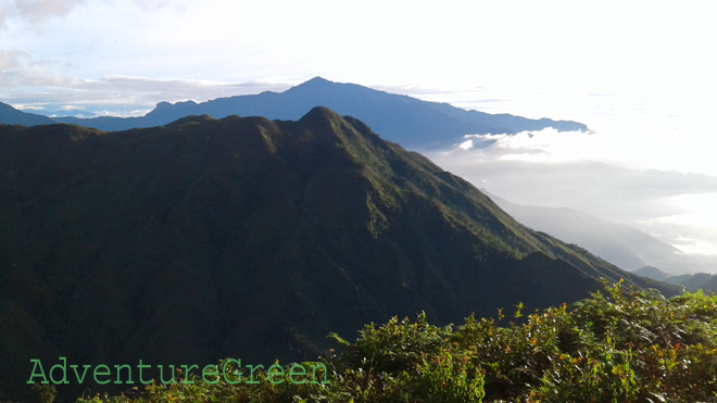
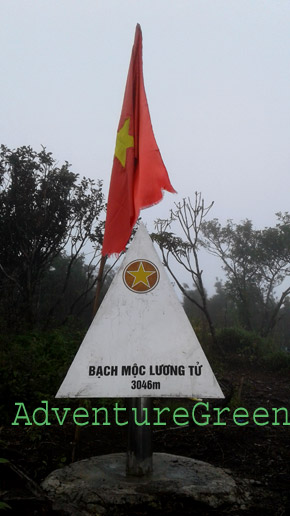
Ky Quan San Mountain (also known as Bach Moc Luong Tu Mountain), of which the peak is 3,046m above sea level, is among the highest mountain peaks in Vietnam.
Travel Guide to Ky Quan San Mountain (Bach Moc Luong Tu) in Lai Chau and Lao Cai
Geography
As the Fansipan Peak on the Hoang Lien Mountain Range has a cable car system installed along with related constructions, it is not as untouched as it used to be. And the adventure travelers love pristine nature. The Ky Quan San seems a perfect replacement.
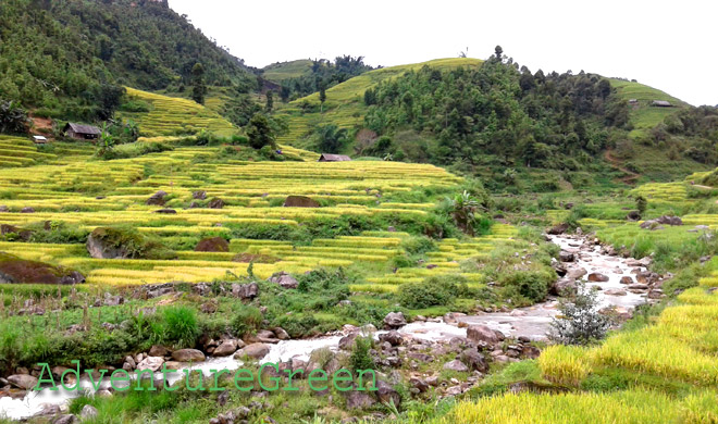
The Ky Quan San Mountain is located on the border between Ky Quan San Village (Sang Ma Sao Commune, Bat Xat District, Lao Cai Province) and Den Sung Village (Sin Suoi Ho Commune, Phong Tho District, Lai Chau Province), in northwestern Vietnam.
Weather and Climate, Best Time to Visit
There may be typhoons in Northern Vietnam between June and October; during this period it may spoil a trip to the Ky Quan San Mountain (Bach Moc Luong Tu) if you happen to travel when the region is under impact of a typhoon. There are about 5-6 typhoons per year hitting northern Vietnam.
Normal weather patterns by month at Mount Ky Quan San are as follows:
+ December – January: winter, dry days mostly, cold and possibly snow/frosts between 20-December and 15-January, peach and plum blossoms in January;
+ February – April: spring, dry days mostly, peach and plum blossoms in February, Rhododendron flowers in March-April;
+ May – August: summer, hot (not on high altitudes), strong sunshine, possible typhoons June-August with torrential rain;
+ September – November: autumn, pleasant temperatures, lovely weather mostly except for time under typhoon impact;
What to expect on the trekking tour
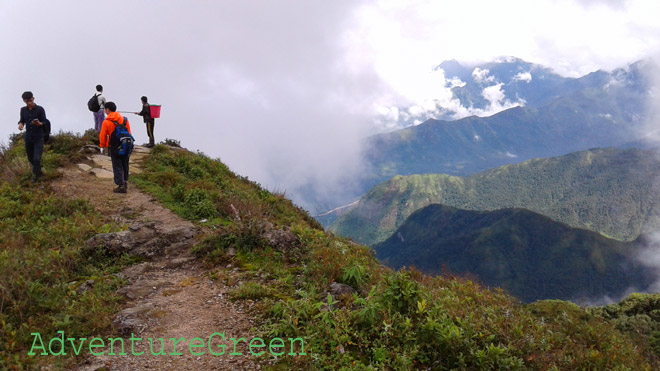
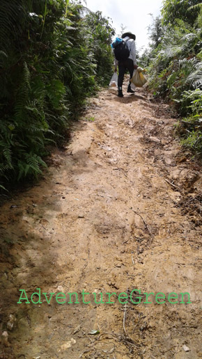
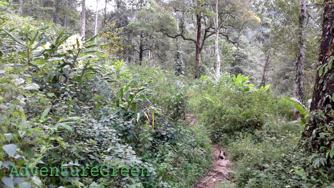
On the first day, the trek is 14km from Sang Ma Sao Village to the Mountain Hut on an elevation of 2,100m. The first leg is via gradually steep mountain slopes. For one third of the way, the trail go through a bamboo forest and then a forest with big timber tree.
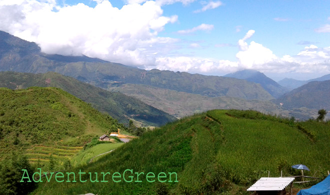
Then another third of the way, the trail goes on a quite flat mountain slope with corn fields.
The last third of the way is in a dense forest with mossy and big timber trees. The trail is uneven and steep going uphill all the way to the hut. This seems the hardest day of all with 10-12 hours trekking.
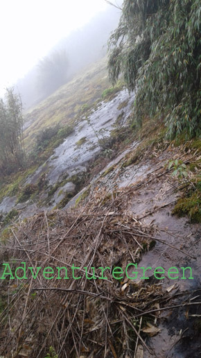
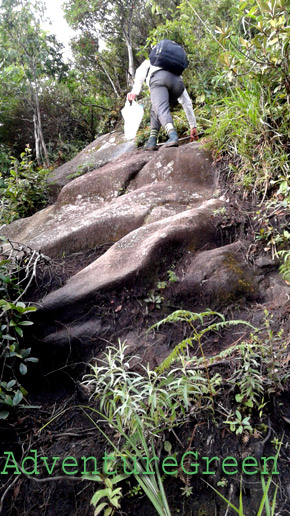
On the second day, it is 4km to the summit with half way on extremely steep and rocky cliffs. The second half way is from 2,800m to the summit which is gradually steep. The trail goes through a thin forest with low and mossy trees, then through a thick bamboo forest on the summit. The winds are very strong all the way. Then another 4km going back the same way to the hut. It should take 4-5 hours to the summit and 3-4 hours downhill back to the hut.
On the third day, we trek 14km again back on the same trail to Sang Ma Sao Village. The trekking time downhill should take 6-8 hours depending on individuals.
Where to stay
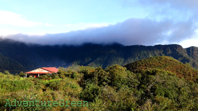
There is a wooden hut on the altitude of 2,100m above sea level at Nui Muoi Mountain for guests to stay overnight. The facilities are poor, but there are showers, Western toilets...outside. Extra charges are applied for hot bucket of water.
How to get there
From Lao Cai City we have to travel to Sang Ma Sao Commune of Bat Xat District first and this leg of the journey is 70km either via Sapa or via Bac Vuoc (Bat Xat). From Sang Ma Sao, it is possible to travel by car or motorbike to Ky Quan San Village where the trekking adventure starts.
Alternatively you can trek to the summit of the Ky Quan San Mountain from Den Sung Village (of the Dao People) in Sin Suoi Ho Commune, Phong Tho District, Lai Chau Province. It is possible to travel by car or motorbike from Lai Chau City to Sin Suoi Ho Commune. The distance is 30km. From the center of Sin Suoi Ho to Den Sung Village it is another 10km on a very bad road that only some motorbikes can travel on.
AdventureGreen organizes hiking tours to Mount Ky Quan San (Bach Moc Luong Tu) along with other spectacular mountain peaks in Lao Cai Province, Vietnam. There are also opportunities to go on hiking tours from one ethnic village to another to learn more about the life of these mountain dwellers. The landscape in Bat Xat is just spectacular.
Lao Cai Average Monthly Rainfalls and Temperatures


