")
")

Tinh Son La Holiday Weather today
Date/time of update: July 4, 2026, 12:53 am, Timezone: GMT+7
Overcast Clouds
Temperature: 23.96°C
Temperature feels like: 24.6°C
Minimum Temperature: 23.96°C
Maximum Temperature: 23.96°C
Atmospheric pressure: 1006hPa
Humidity:84%
Visibility: 10000m
Wind speed: 0.45m/sec
Wind Direction: 76 degrees
Cloudiness: 99%
Sunrise: 2026-07-03 10:26:34
Sunset: 2026-07-04 11:49:45
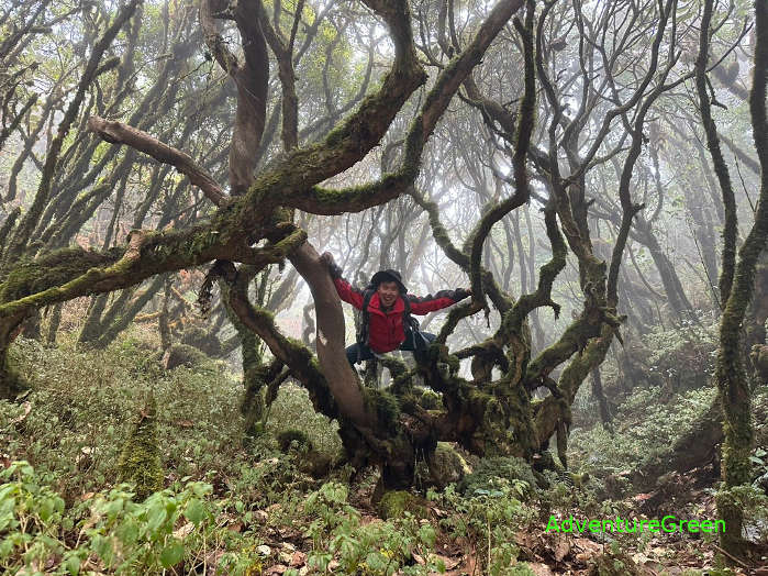
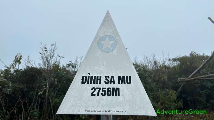
The Sa Mu Peak, or U Bo Peak belongs to the Ta Xua Mountain Range stretching along the border between Yen Bai Province and Son La Province. The mountain peak is 2,756m above sea level.
Travel Guide to the Sa Mu Peak (U Bo Mountain) in Son La
Geography
To the north of the mountain is Ban Mu Commune, Tram Tau District, Yen Bai Province. To the south of the mountain is Xim Vang Commune, Bac Yen District, Son La Province. From Xim Vang, there is a trekking trail to the peak of Sa Mu and this peak is still rarely visited by travelers. It is 20km from Ta Xua to Xim Vang where the trek starts. A trekking tour to the summit takes 2 days, 1 night.
How to get there
From Hanoi follow Route 32 and Route 37 heading northwest for 200km to Ta Xua Commune (in Bac Yen District, Son La Province). This leg of the journey is with good road conditions, mostly flat but hilly and mountainous from Route 37 in Son La.
Then from Ta Xua travel by motorbike for 20km northwest on the provincial route 112 to Xim Vang Commune where the trek starts. This leg of the trip is with a small road which could be in bad conditions during the rainy times.
Son La Average Monthly Rainfalls and Temperatures


