")
")

Tinh Yen Bai Holiday Weather today
Date/time of update: July 28, 2026, 12:54 am, Timezone: GMT+7
Light Rain
Temperature: 23.69°C
Temperature feels like: 24.67°C
Minimum Temperature: 23.69°C
Maximum Temperature: 23.69°C
Atmospheric pressure: 1007hPa
Humidity:98%
Visibility: 8651m
Wind speed: 0.29m/sec
Wind Direction: 262 degrees
Cloudiness: 100%
Sunrise: 2026-07-27 10:32:36
Sunset: 2026-07-28 11:42:50
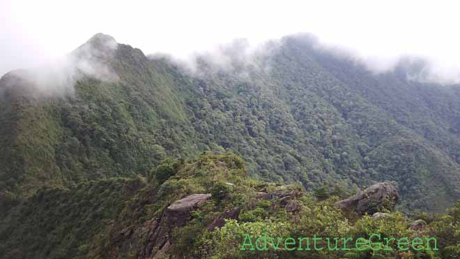
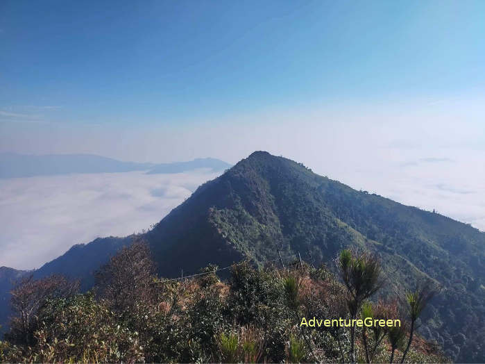
The Ta Xua Mountain is located in Tram Tau District, Yen Bai Province. The peak of the mountain is 2,865m above sea level and this is among the highest mountain peaks in Vietnam.
Travel Guide Overview for Ta Xua Mountain in Yen Bai
The Ta Xua Mountain Range, which runs northwest-southeast, forms part of the natural border between Yen Bai Province to the east and Son La Province to the west. The three highest peaks of the Ta Xuan Mountain are in Tram Tau Yen Bai.
The stretch to the southeast of the mountain is where Ta Xua Nature Reserve is located. This area belongs to Son La Province.
Except for the peaks in Tram Tau and the area to the southeastern stretch, Ta Xua Mountain Range remains undiscovered. This travel guide is dedicated for the adventure to the three peaks of the Ta Xua Mountain.
Weather and Climate, Best Time
+ Summer: May – August, strong sunshine, hot temperatures (33-39oC), possible typhoons between June-August;
+ Autumn: late August – early November, the maple leaves turn red or yellow in September-November, possible typhoons in August-October;
+ Winter: late November through January or early February, peach and plum blossoms in January-February;
+ Spring: February – April, the Rhododendron offers full blossoms;
There may be typhoons in June – October which make a trekking trip to the Ta Xua Mountain not possible. There are more or less than 10 typhoons per year hitting inland Vietnam and half of which go to the North. There are several beautiful autumnal days between September – November that are great for climbing the Ta Xua Mountain. And typhoons can often be forecast 10 days in advance.
Winter months are cold and dry and there may be frost or snow on the mountain peaks. Some love snow would choose the winter to hike up the mountain then. The coldest time is often between mid December to mid January.
Spring time is certainly beautiful with blossoms everywhere: peach, plum, rhododendron...
What to expect from a trekking tour to Mount Ta Xua Yen Bai
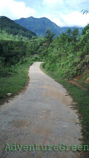
1/ Tram Tau – Ta Xua Village (5km)
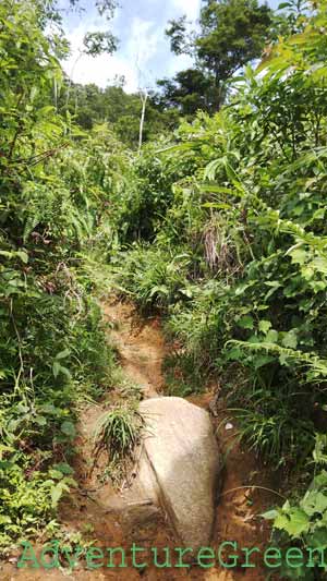
This leg of the adventure is done by motorbike. The trail is small and gradually steep; it could be very slippery when it is wet.
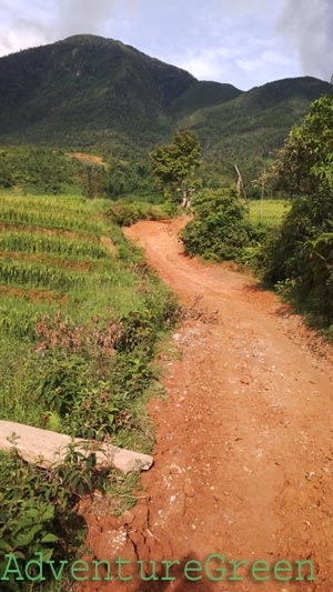
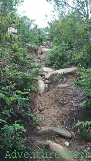
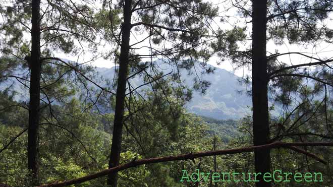
2/ Ta Xua Village – Dinosaur Backbone (8km, 7-8 hours)
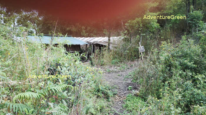
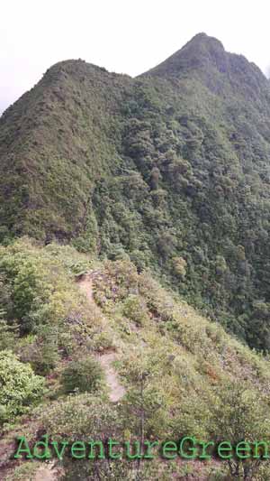
The trail goes up steeply most of the time (5-6 hours). It is quite slippery even on a dry day and there are no leaning points on the way up. Then it gets more on flat ground near the Dinosaur Backbone which is also the first peak of Ta Xua. Right before the Dinosaur Backbone is one of the two wooden huts.
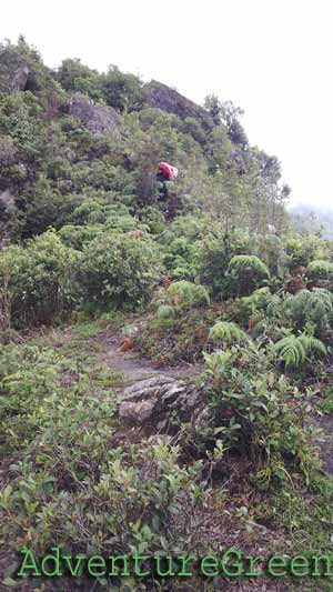
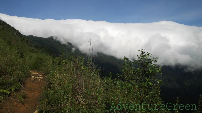
The Dinosaur Backbone is like a bridge connecting to sides of a mountain gorge. The wind blows very hard and the mountainsides are vertically steep. It is only 2-2.5m wide. It used to be fatally dangerous but now things get a bit less dangerous thanks to the railings installed in 2020. Caution must be exercised crossing this leg still.
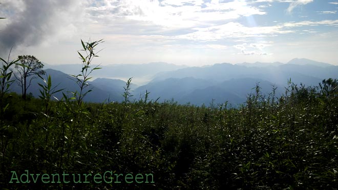
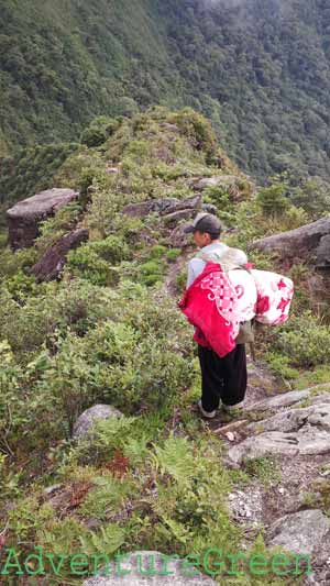
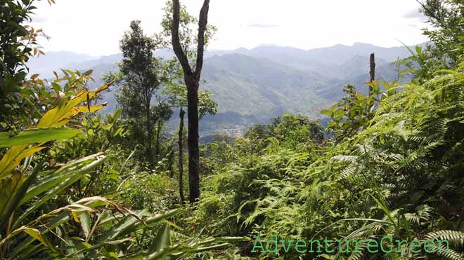
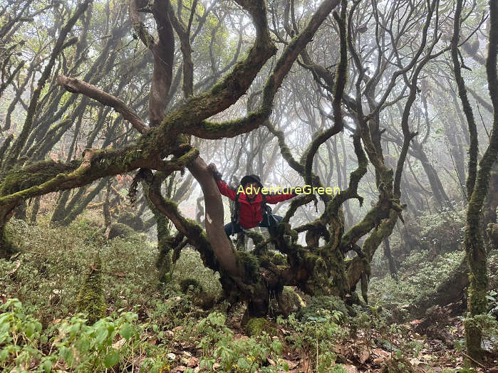
3/ Dinosaur Backbone – Peak No. 3 and Peak No.2 (4km each way, 6-7 hours)
The trail is less steep and the landscape changes suddenly with dense forest of mossy trees and mossy roots. The leg from Peak 3 to Peak 2 passes through an area with wildfire some time ago. The second hut is approximately 1 hour trek from the Dinosaur Backbone.
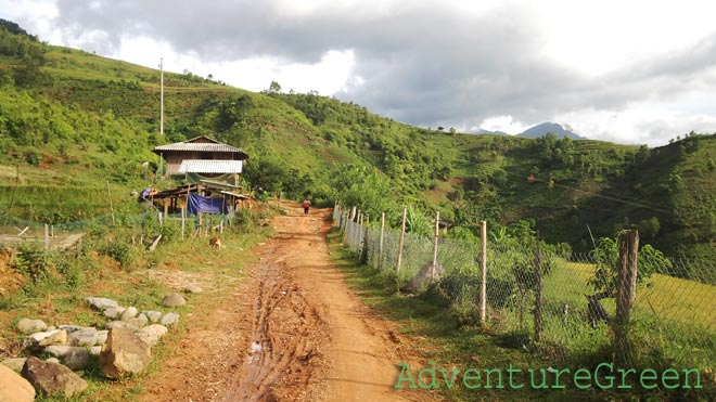
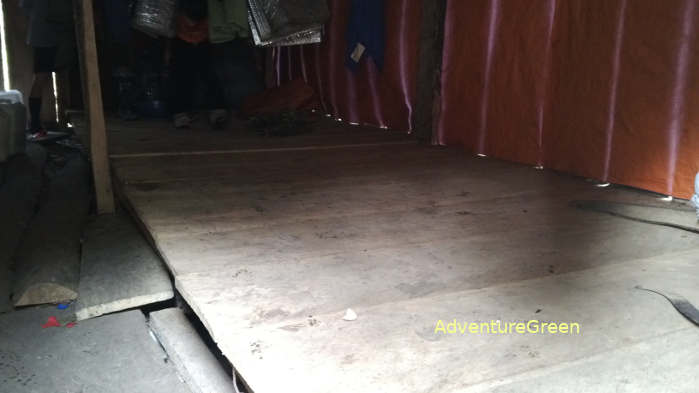
Where to stay
There are wooden huts before and after the Dinosaur Backbone (2,300m) with poor facilities each of which could accommodate 20-30 persons a night. There is only one rudimentary toilet at each hut.
How to get there
From Hanoi we travel northwest via Route 32 to Nghia Lo Town which is 150km away. And from Nghia Lo to Tram Tau it is 40km east. The base to start the trek is at Ta Xua Village, 5km west of Tram Tau Township.
Yen Bai Average Monthly Rainfalls and Temperatures


