")
")

Tinh Quang Ngai Holiday Weather today
Date/time of update: April 20, 2026, 7:56 am, Timezone: GMT+7
Clear Sky
Temperature: 30.58°C
Temperature feels like: 29.58°C
Minimum Temperature: 30.58°C
Maximum Temperature: 30.58°C
Atmospheric pressure: 1006hPa
Humidity:33%
Visibility: 10000m
Wind speed: 4.33m/sec
Wind Direction: 76 degrees
Cloudiness: 0%
Sunrise: 2026-04-19 10:28:15
Sunset: 2026-04-20 11:00:02
Quang Ngai Province is in the Central Region of Vietnam, south of Da Nang City and north of Binh Dinh Province. The western flank of Quang Ngai is is Kon Tum and the southwest of Quang Ngai is bounded by Gia Lai Province.
Geography
Quang Ngai terrain is higher to the west which is mostly mountainous, and lower to the east which includes flat sand dunes along flat coastline, or rugged coastline with some low hills.
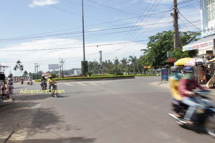
 The countryside of Quang Ngai Province
History
Quang Ngai is home to the Ancient Culture of Sa Huynh (dating back to around 1,000 year B.C.) which along with Oc Eo and Dong Son Cultures makes up the ancient culture of what is Vietnam today.
Quang Ngai was later the territory of the ancient Champa Kingdom, Quang Ngai and Binh Dinh Provinces were where the recently discovered "Great Wall" or "Silk Road" of Vietnam - Truong Luy, which stretches for 200km connecting the mountainous region and the coastal region of Vietnam.
Tourist Attractions, Things to Do
Visiting Quang Ngai, you can travel back in time of the ancient culture at the numerous archaeological sites or just relax by the fine white sand of Sa Huynh or My Khe. Those of you interested in history can find numerous painful memories from the recent war in Vietnam at Son My - My Lai Massacre Site or at Duc Pho District with brutal “Search and Destroy” operations during the war. More information of different tourist attractions in Quang Ngai including several off-the-tourist track sites are listed below.
1/ Thien An Mountain (Heavenly Seal)
The 106m-high mountain is located on the northern bank of the Tra Khuc River, 3-4km northeast of Quang Ngai City. The name comes from the unique shape of the mountain which looks like a huge seal on a flat terrain with sweeping views of the surrounding.
The mountain top is a flat area with a Buddhist pagoda of the same name built in 1694-1695.
2/ My Khe Beach
The beach has the same name as another famed beach in Da Nang City. My Khe Beach in Quang Ngai Province is 17km northeast of the provincial capital. The beach is pristine and flat with crystal clear sea water.
3/ Sa Huynh Salt Fields
The Salt Fields of Sa Huynh have become well-known among photographers in Vietnam for several years for amazing scenes of farmers at work. The scenes are most beautiful at dawn and at dusk. These salt fiels are 65km south of Quang Ngai City.
4/ Sa Huynh Beach
The beach is about a kilometer in length with white sand and blue water. There is a luxury beach resort on the beach and there are several mini hotels in the neighborhood.

Sa Huynh Beach - Quang Ngai - Vietnam
5/ Go Co Village
The village is perched on a low hill slope overlooking the sea. The low hills in the rear relatively separate the village from the mainstream world. There are houses under the canopy of coconut forest. It is here that vestiges of the Sa Huynh Culture, which thrived in Vietnam 2,000 years ago, are preserved. It is here that the Cham continued the heritage of the Sa Huynh Culture which lasted for several centuries.
In the front, there is a stretch of sandy beach which is a real paradise for escape holidays.
The Go Co Village is adjacent the Sa Huynh Beach to the south.
6/ Ca Dam (K’Dam) Mountain
The mountain in Tra Bong District is on the elevation of 1,400m above sea level with cool climate all year round. The Ca Dam Mountain has untouched forest with several precious flora species which are great for health: ginseng, tea.... Besides, this is a sacred mountain revered by the local Cor ethnic people.
Tourism has a great potential but there have been no investments just yet. The road to the mountain was built in 2015 only. The Ca Dam Mountain is 70km northwest of Quang Ngai City.

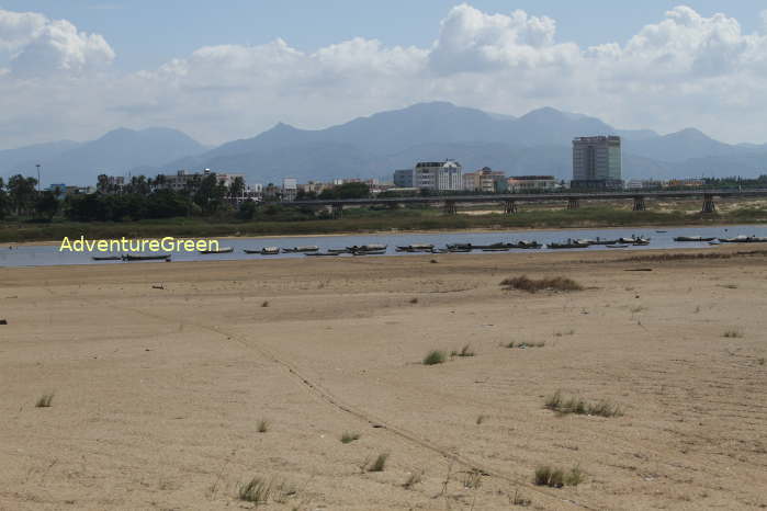
The Tra Khuc River - Quang Ngai - Vietnam
How to get there
Quang Ngai City is the provincial capital of Quang Ngai Province. Quang Ngai City is 130km south of Da Nang, 180km north of Quy Nhon City (Binh Dinh Province).
There are several trains between Hanoi and Ho Chi Minh City which stop at Quang Ngai everyday.
Quang Ngai Average Monthly Rainfalls and Temperatures


